Airborne laser scanning (ALS) Technology;
Fog Global Technologies provides airborne laser scanning followed by data analysis with receiving the following main results:
- classified point clouds of laser reflections;
- digital elevation models;
- 3D models of a territory.


Acquired data
- The .LAS format. The average density of points is 60-80 per m²


- The .LAS format. The average density of points is 63.9 per m²;
- The average density of points, the Earth class is 1.6 per m²;
- The average density of points, the Low vegetation class is 19.1 per m²;
- The average density of points, the Average vegetation class is 4.4 per m²;
- The average density of points, the High vegetation class is 34.3 per m²;
- The average density of points, the Building class is 1.2 per m²;
- No classified 3.0 per m².
- Allows creating horizontal lines with a cross-section of 0.5m;
- The GeoTiff, ASCII Grid, BIL, XYZ formats;
- Resolution is up to 20 cm/pix;
- Standard deviation is 15cm.

The software allows building a three-dimensional polygonal model of an object after processing point clouds of laser reflections.

ALS process
Our UAV performs ALS at the altitude up to 150 metres in automatic mode.

- Receiving permissions for aerial photography
- Carrying out aerial photography with the UAV.

Points of laser reflections:
- Processing data from the GNSS receiver and the inertial system of the scanner with obtaining the flight path;
- Creating an unclassified point cloud along the flight path and points of laser reflections;
- Point cloud classification;
- Modeling derived products from a classified point cloud.
Images: - Phototriangulation;
- Building orthophotos.
Comparison of magnetic survey data
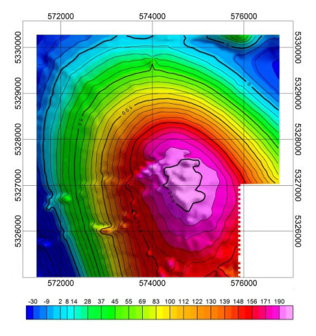
ММС-214 aviational magnetometer was used in 1988 to perform survey on the same site, where Geoscan 401 Geophysics system was applied in 2017. The results comparison is presented:

| year 1988 AN-2, ММС-214 Survey scale 1:25 000 |
year 2017 Geoscan 401 Geophysics Survey scale 1:10 000 |

| year 1988 AN-2, ММС-214 Survey scale 1:25 000 |
year 2017 Geoscan 401 Geophysics Survey scale 1:10 000 |
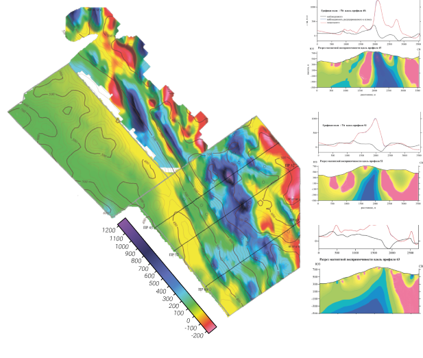
In January, 2019, Fog Global Technologies specialists performed aeromagnetic survey in north-western part of Laos Republic on Aurora site. The results are presented as a abnormal magnetic field map and a set of profiles.
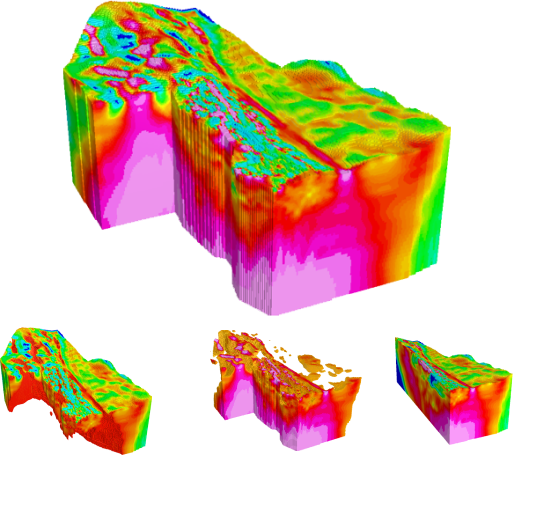
This model shows the site’s geological structure and allows to observe highly magnetic linear zones, which, possibly, correspond with Mt+Cu+Au mineralization with large amounts of copper, iron ore and gold.

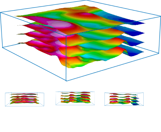
To acquire enough data on specified territory, it is necessary to explore it multiple times, placing magnetometric sensor on different altitudes. Most affordable and convenient way to do this is using UAV multi-level measurements method.
The results are most efficient to locate sub-surface geological structures, their form and three-dimensional positioning.

Aeromagnetic UAV survey results can be presented as volumetric model.
This model represents internal geological structure of the site and helps to visualize it properly.
It is also possible to set values range to distinguish different magnetic structures from one another.
In-depth modelling allows to evaluate reserves and calculate them with extreme accuracy.
