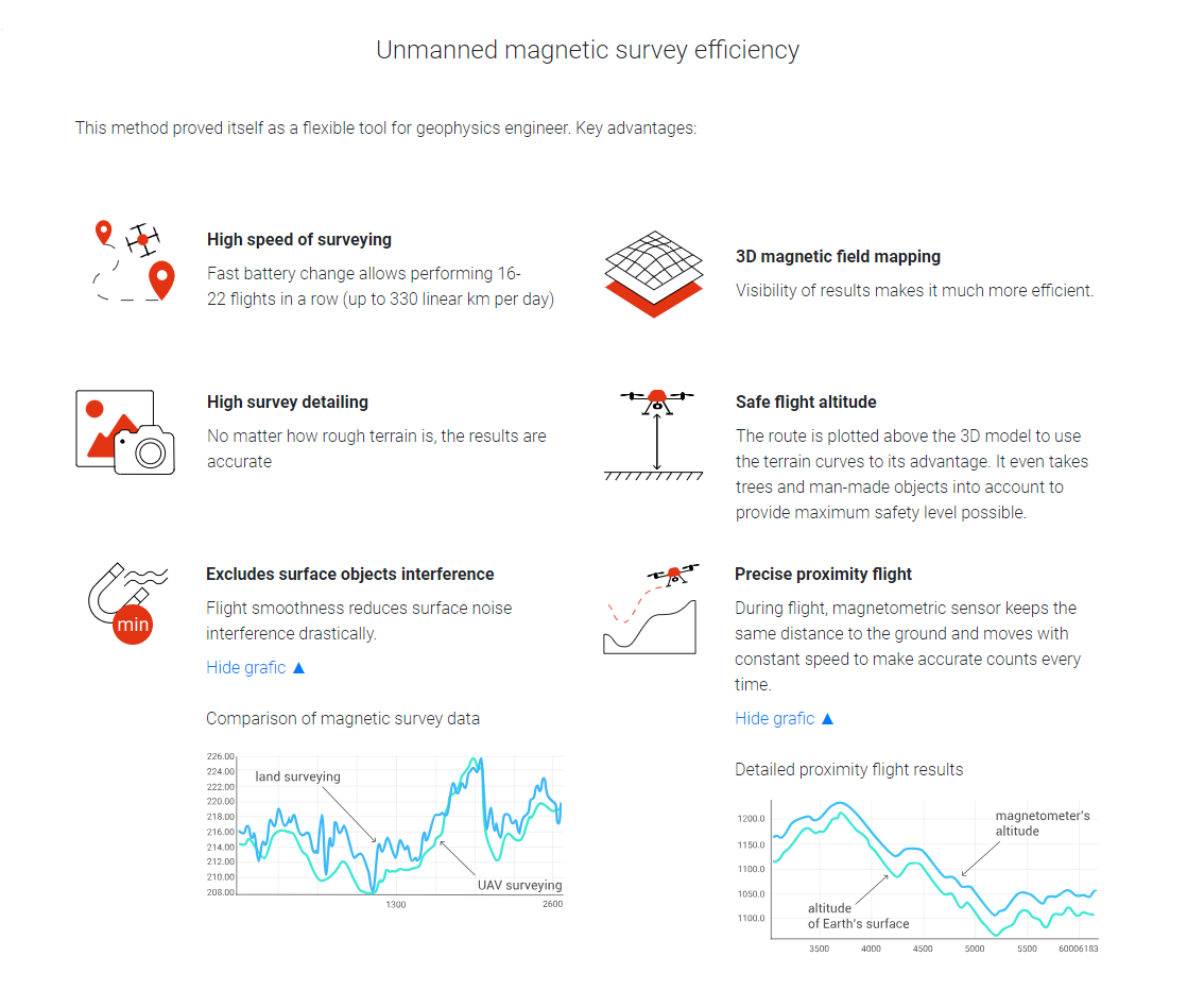
Comparison of magnetic survey data
ММС-214 aviational magnetometer was used in 1988 to perform survey on the same site, where Geoscan 401 Geophysics system was applied in 2017. The results comparison is presented:
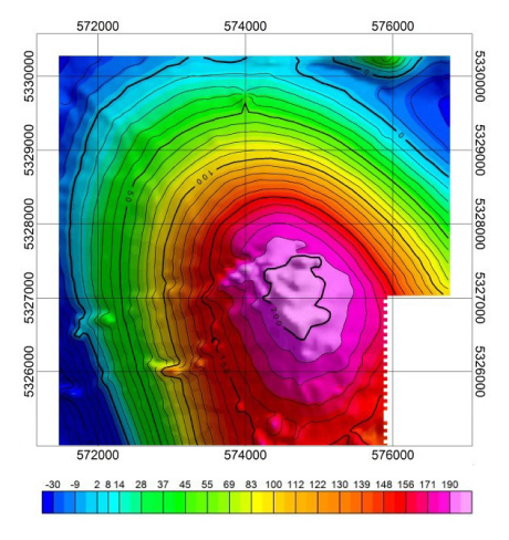
| year 1988 AN-2, ММС-214 Survey scale 1:25 000 |
year 2017 Geoscan 401 Geophysics Survey scale 1:10 000 |

| year 1988 AN-2, ММС-214 Survey scale 1:25 000 |
year 2017 Geoscan 401 Geophysics Survey scale 1:10 000 |
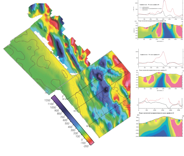
In January, 2019, Fog Global Technologies specialists performed aeromagnetic survey in north-western part of Laos Republic on Aurora site. The results are presented as a abnormal magnetic field map and a set of profiles.
This model shows the site’s geological structure and allows to observe highly magnetic linear zones, which, possibly, correspond with Mt+Cu+Au mineralization with large amounts of copper, iron ore and gold.
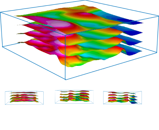
To acquire enough data on specified territory, it is necessary to explore it multiple times, placing magnetometric sensor on different altitudes. Most affordable and convenient way to do this is using UAV multi-level measurements method.
The results are most efficient to locate sub-surface geological structures, their form and three-dimensional positioning.
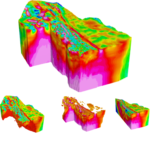
Aeromagnetic UAV survey results can be presented as volumetric model.
This model represents internal geological structure of the site and helps to visualize it properly.
It is also possible to set values range to distinguish different magnetic structures from one another.
In-depth modelling allows to evaluate reserves and calculate them with extreme accuracy.
